Announcing the Expansion of Whale Safe to San Francisco
We are excited to announce we have partnered with The Marine Mammal Center, along with leading scientists, to bring the next Whale Safe system to the San Francisco region!
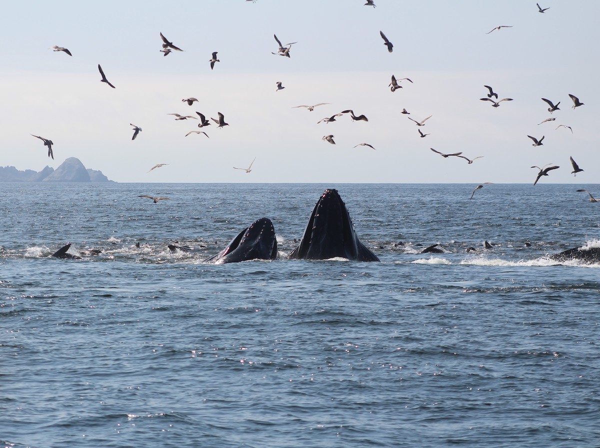
Photo Credit: Bekah Lane, The Marine Mammal Center
Why San Francisco?
The water off of San Francisco provides rich feeding grounds for endangered and threatened blue, fin, and humpback whales, with some traveling thousands of miles to feed on krill and shoals of anchovies, sardines, and herring. These feeding grounds overlap with busy shipping lanes leading to and from San Francisco Bay ports, a major maritime commerce hub with thousands of vessels transiting these waters each year.
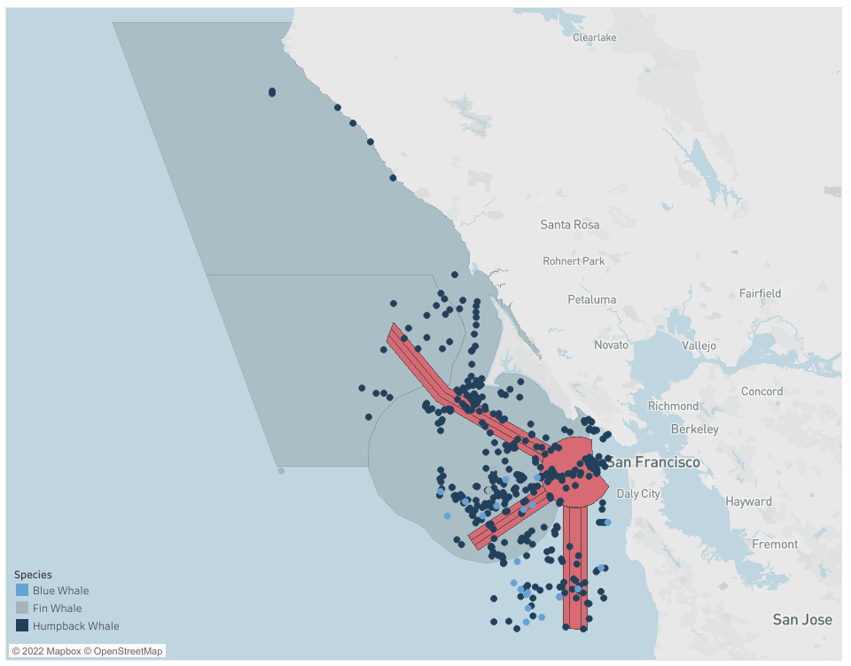
Sightings of blue, fin, and humpback whales between January 1, 2020 to August 31, 2022 from Whale Alert, Spotter Pro, Happywhale, and iNaturalist.
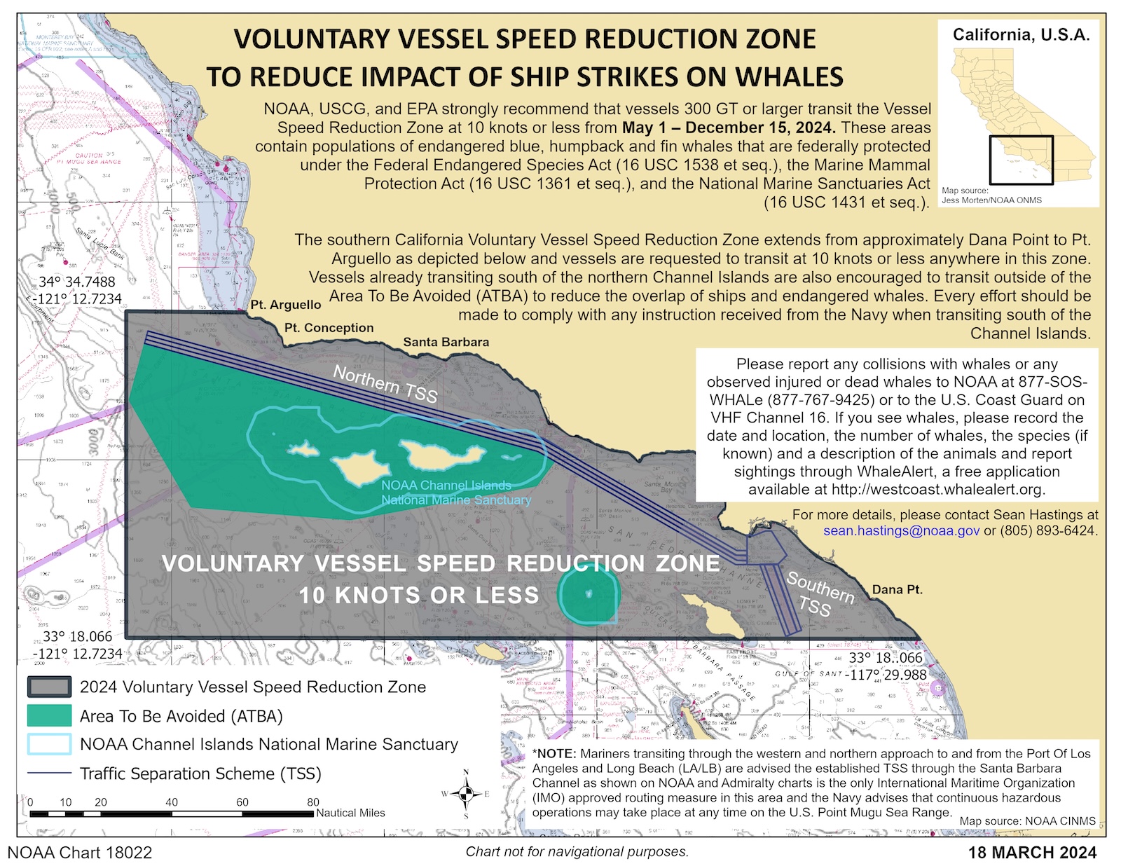
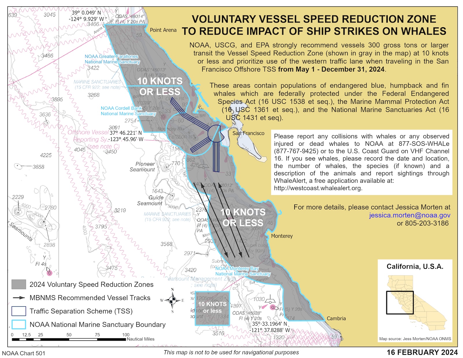
In areas like these, where feeding grounds overlap with heavily-trafficked shipping routes, there is an elevated risk of fatal whale-ship collisions, one of the leading causes of deaths for whales. That is why NOAA, the U.S. Coast Guard, and Environmental Protection Agency annually issue voluntary Vessel Speed Reduction Zones asking large vessels to slow down to 10 knots or less in both the Santa Barbara Channel and the waters off of San Francisco.
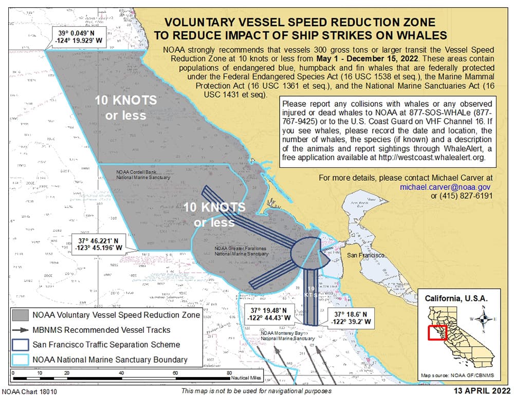
NOAA and the Coast Guard implemented a 10 knot voluntary speed limit for large ships transiting the region from May 11 – December 15, 2022. This notice is sent to vessels via the Coast Guard Local Notice to Mariners.
This elevated risk of whale-ship collision and the on-going work by our partners to reduce this threat makes this area a prime location for the next Whale Safe system. By expanding our network to the San Francisco region, we are able to create a more comprehensive whale detection network along the California Coast that gives the shipping industry, resource managers, and other stakeholders more real-time information about whale presence along major shipping routes.
Video by Q Branch Video team at Salesforce
San Francisco Whale Safe System
Using the Southern California system as a blueprint, we were able to scale this technology solution to the San Francisco region. The new system uses the same technology to create a daily whale presence rating from an AI-powered acoustic monitoring system, a dynamic blue whale habitat model, and whale sightings, as well as vessel analytics and reporting from Automated Identification System (AIS) data.
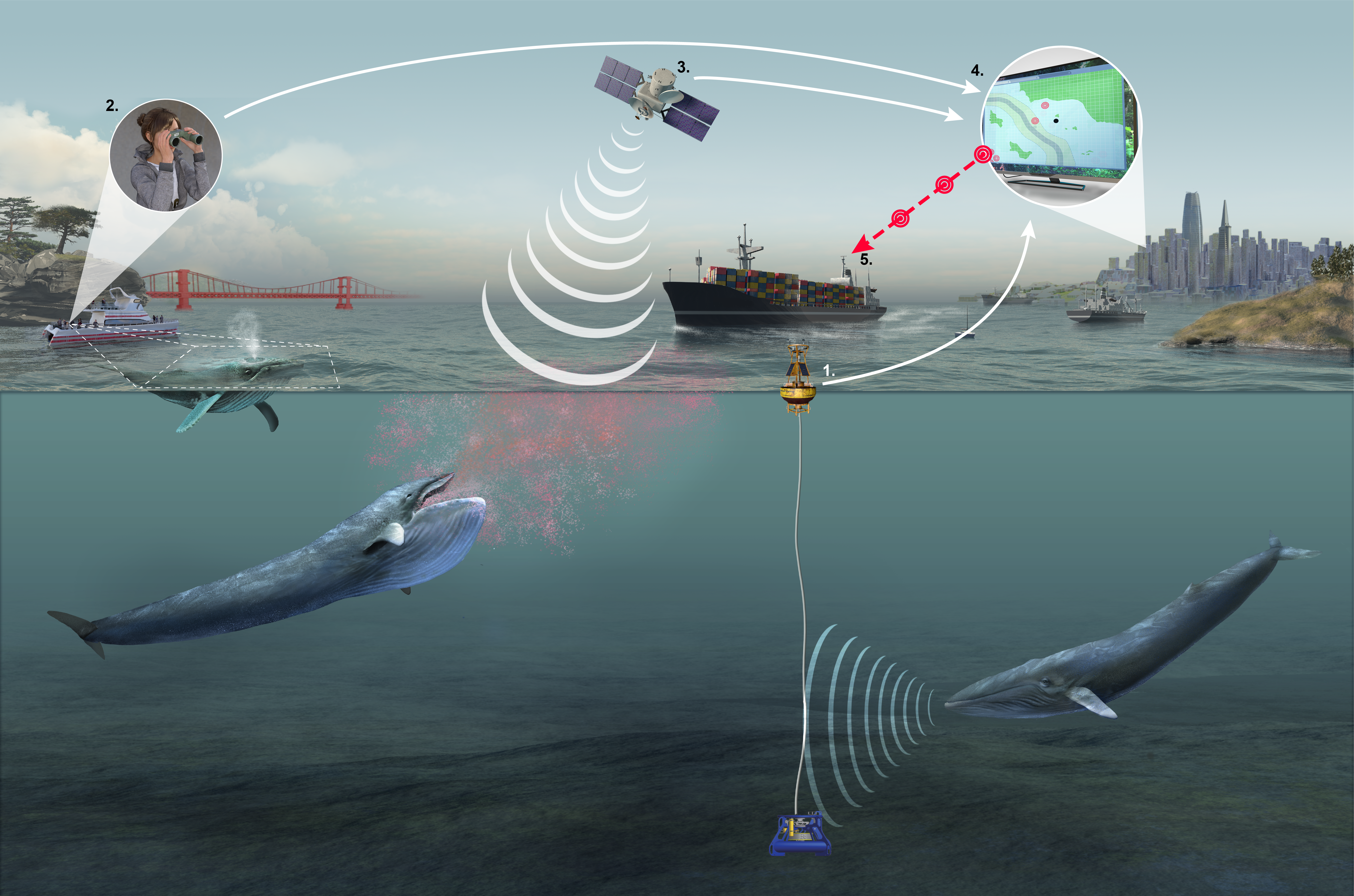
Whale Safe incorporates 1) Acoustic monitoring system identifies blue, humpback, and fin whale vocalizations, 2) Observers record whale sightings aboard whale watching boats or aircrafts, 3) Oceanographic data is used to predict where blue whales are likely to be each day, 4) The three near real-time whale data streams are compiled and validated, 5) Whale information is disseminated to industry, managers, and the public.
We were able to build off the lessons learned and successes from our pilot system in Santa Barbara, especially since both regions host the same species. However, there were still some new challenges we had to consider in adapting this system to the San Francisco waters. Our team carefully considered where to put the acoustic buoy and how to moor it given the different bathymetry in the Gulf of the Farallones and adjacent water.
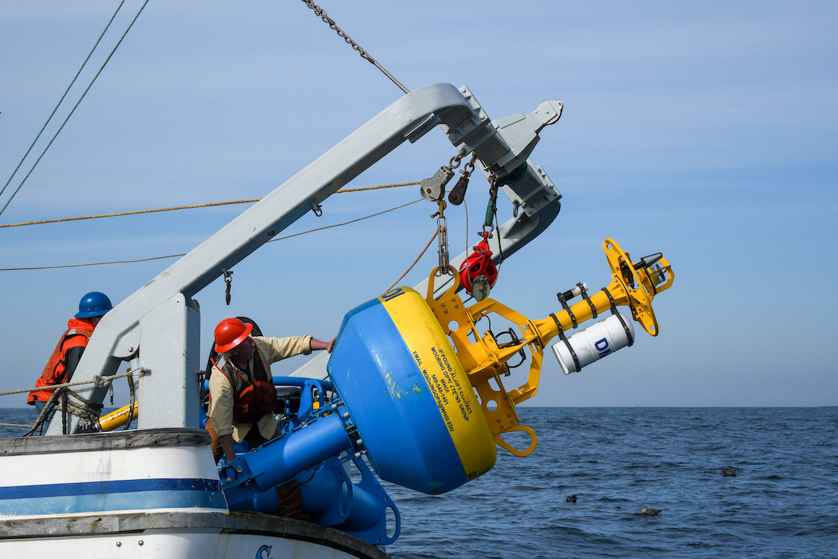
Photo Credit: Bekah Lane, The Marine Mammal Center
Every day for the last month, we have been hearing blue and humpback whales.
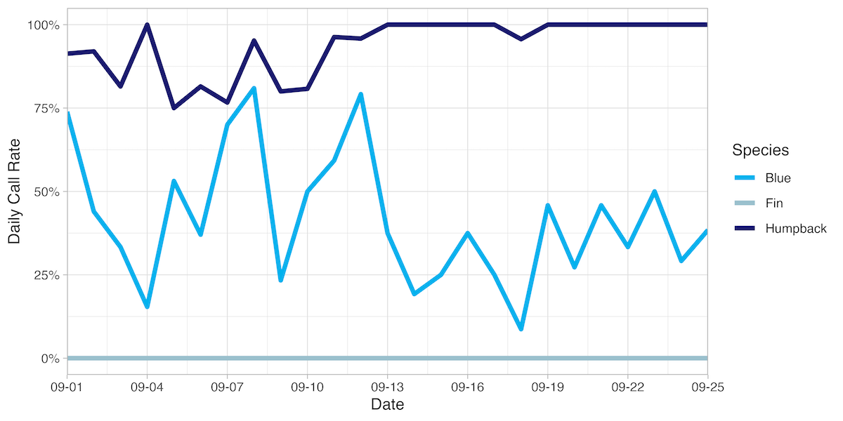
Acoustic detection data for blue, humpback, and fin whales transmitted from the moored buoy system in 15-minute summary periods. The Daily Call Rate is the percentage of 15-minute summary periods with confirmed acoustic detections of each species each day.
Sightings data via Whale Alert and Spotter Pro are collected by our partners at Point Blue Conservation Science at the Farallon Island Lighthouse, and via surveys and the citizen science network of The Marine Mammal Center. Below is an overview of sightings collected by our partners since May 1 of this year.
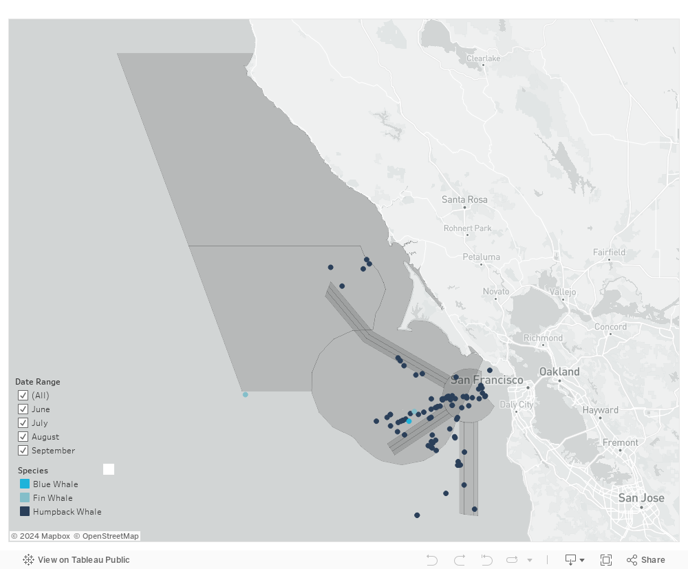
Sightings of blue, fin, and humpback whales between May 1 to September 20, 2022 from Whale Alert and Spotter Pro.
The dynamic blue whale habitat model was validated over the shipping corridor in the San Francisco region to produce a daily average suitability score. All three of these updated data streams are integrated into a whale presence rating using the same methodology as the Santa Barbara system (see our methodology for more information). This near real-time whale presence rating is available to mariners via our website, email alerts, twitter, or directly through our API.
Vessel analytics and reporting is also now available for this region via the Whale Safe tool on our website. The tool ranks vessels and shipping companies according to their rates of cooperation with NOAA’s voluntary speed restrictions and provides downloadable report cards summarizing the information for each company. In the tool, you can select to see this information for each region or aggregated showing data for both San Francisco region and Santa Barbara Channel combined.
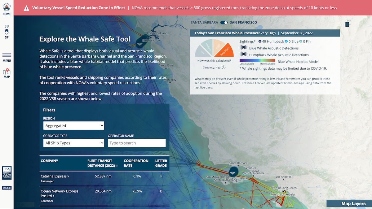
Whale Safe vessel analytics showing aggregated data for both San Francisco and Santa Barbara Channel
We are beyond excited to have this system up and running! This new node gives us a more complete picture of whale presence off the California coast and will show the efficacy and adaptability of this tool for other locations where whales are at risk of collision with ships.
We also want to say a big thank you to Marc and Lynne Benioff for their ongoing support of UC Santa Barbara and the Benioff Ocean Science Laboratory (formerly the Benioff Ocean Initiative). The expansion of Whale Safe was made possible by their legacy of support, including their recent gift of $60 million to UC Santa Barbara.
You can sign up for daily or weekly whale presence alerts, or monthly shipping report cards here.