Map

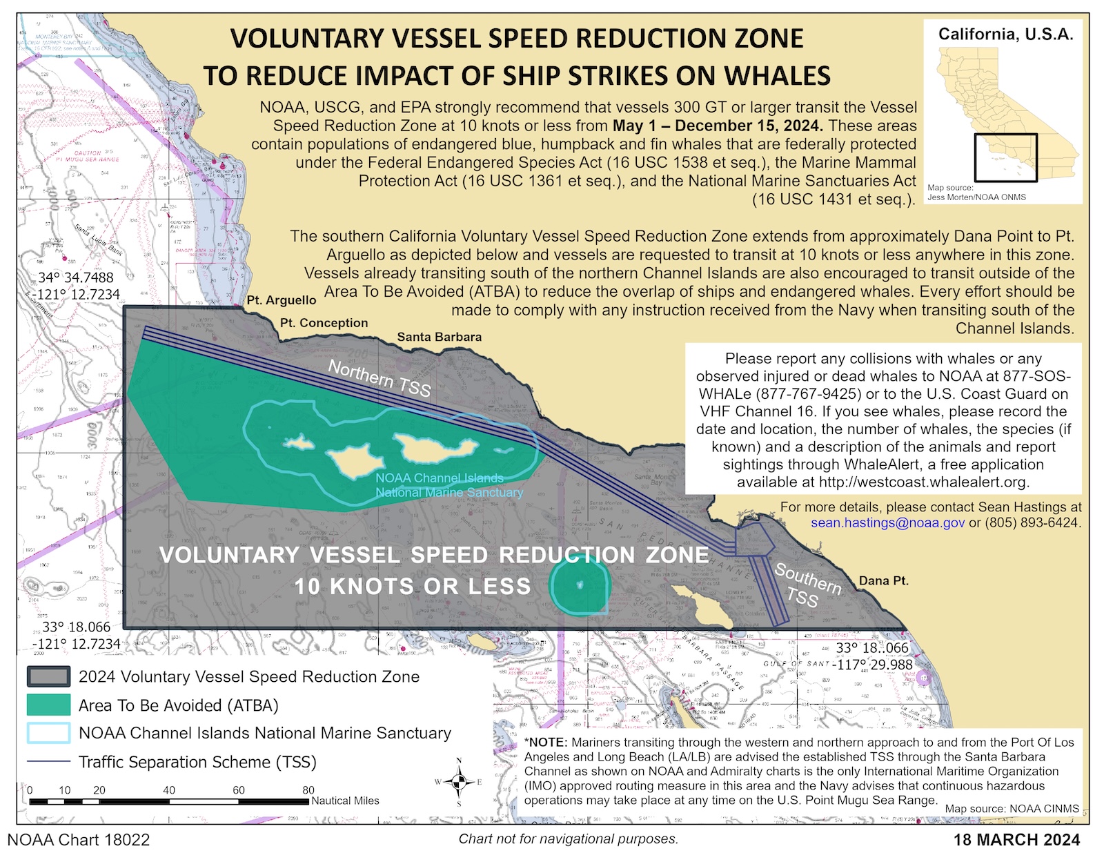
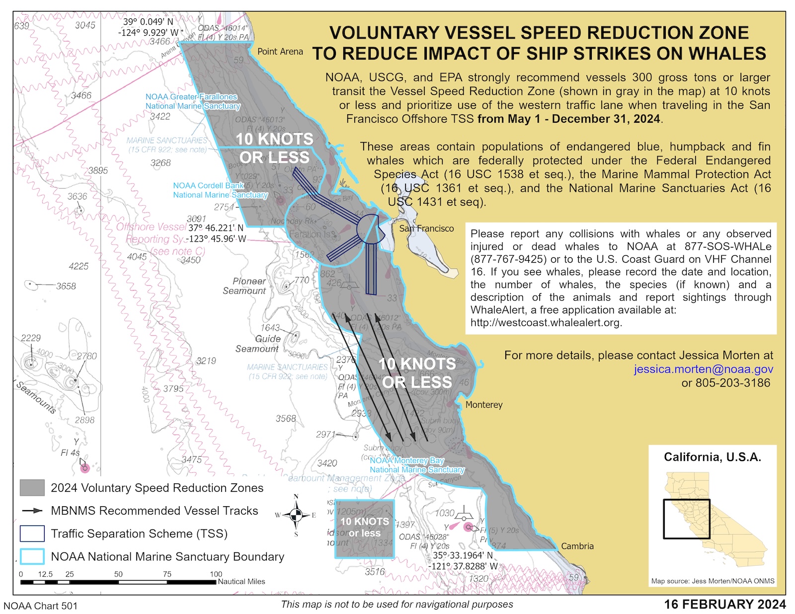
Voluntary Vessel Speed Reduction Zone In Effect NOAA recommends that vessels > 300 gross registered tons transiting the zone do so at speeds of 10 knots or less

2018, 2019, and 2021 Were the Worst Years on Record for Whale-Ship Collisions off the West Coast of the United States.

Despite this trend, there are solutions to combat the problem. Research demonstrates ships that slow to 10 knots in areas with high whale presence significantly reduce the danger to whales.

Whale Safe is a technology-based mapping and analysis tool displaying whale and ship data—designed to prevent fatal ship collisions with whales.

Explore the Whale Safe Tool

Today's Santa Barbara Channel Whale Presence: High*

Today's Santa Barbara Channel Whale Presence: High  |  June 15, 2026

High Presence of Whales How was this calculated?
Certainty: High
June 15, 2026
Sightings* 18 Humpback 0 Blue 0 Fin

Blue Whale Habitat Model

Santa Barbara acoustic system is offline

Whales may be present even if whale presence rating is low. Please remember you can protect these sensitive species by slowing down. Presence Tracker last updated 1 hour ago using data from the last five days.

Today's San Francisco Whale Presence: Very High*

Today's San Francisco Whale Presence: Very High  |  June 15, 2026

Very High Presence of Whales How was this calculated?
Certainty: High
June 15, 2026
Sightings* 3 Humpback 13 Blue 27 Fin

Blue Whale Habitat Model

San Francisco acoustic system is offline

Whales may be present even if whale presence rating is low. Please remember you can protect these sensitive species by slowing down. Presence Tracker last updated 1 hour ago using data from the last five days.

Today's San Francisco Bay Whale Presence: Very High*

Today's San Francisco Bay Whale Presence: Very High  |  June 15, 2026

Very High Presence of Whales How was this calculated?
June 15, 2026
Sightings* 0 Humpback 7 Gray 32 Whale (Unclassified)

Sightings from thermal camera: 32

Sightings from human observation: 7

Whales may be present even if whale presence rating is low. Please remember you can protect these sensitive species by slowing down. Presence Tracker last updated 38 minutes ago using data from the last three days.

Loading...

Map Layers

Species Sightings

Modeling

Marine Traffic

Time Range