Scroll to Learn More
The coast of California hosts a vibrant and dynamic ecosystem and economy.
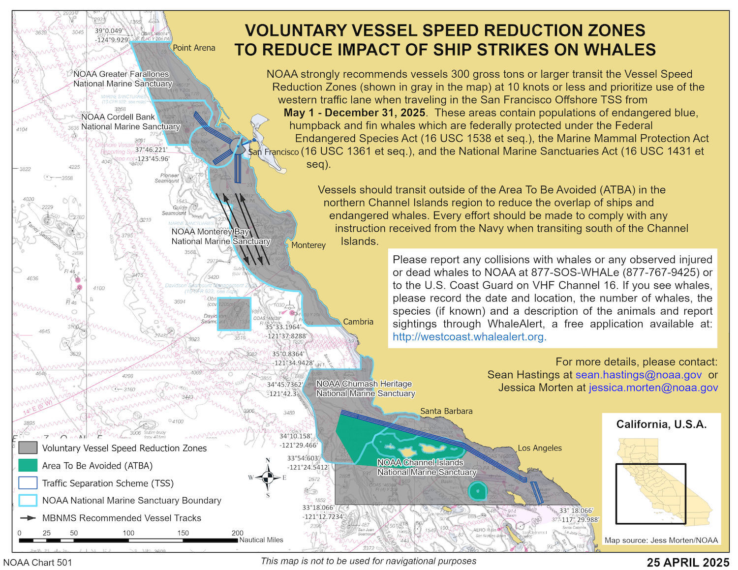
This is the Santa Barbara Channel, a 70-mile stretch of ocean separating mainland California from the Northern Channel Islands.
The Channel supports robust international shipping routes to and from the ports of Los Angeles and Long Beach.
This is the San Francisco Bay region.
The San Francisco Bay region supports robust international shipping routes to and from the ports of Oakland, Richmond, Benicia, Redwood City, and San Francisco.
These two regions are also home to many endangered whale species that feed in the area. We have ways of seeing, hearing, and predicting when whales are present.
To protect these whales, the National Oceanic and Atmospheric Administration (NOAA) has made significant progress implementing voluntary speed restrictions for large vessels transiting through sensitive whale habitat. Research demonstrates ships that slow to 10 knots in areas with high whale presence significantly reduce the risk of fatal collisions. Yet, whale-ship collisions are still on the rise off the U.S. West Coast.
![]()
Whale Safe is a technology-based mapping and analysis tool displaying whale and ship data with the goal of helping to prevent fatal ship collisions with whales.